A Weekend of California Fire Reporting Through Atlasphere
As fires burn all around the San Francisco Bay Area in August, 2020, I’ve been most anxious about the fire devastating the Santa Cruz Mountains, threatening homes of family members including my children. News about the heavily wooded towns of Boulder Creek and Ben Lomond is difficult to come by, since the limited road access is blocked by the widespread evacuation orders. There is intense interest from the local community as to what is happening on an ongoing basis.
News articles, such as those written by Mallory Moench (opens in a new tab) (LinkedIn profile (opens in a new tab)) of the San Francisco Chronicle, reflect foot-on-the-ground coverage. Tweets from those still in the vicinity give additional context. I spent the weekend capturing what I could of the scene to report summaries and references to articles in a map-based approach with Atlasphere.
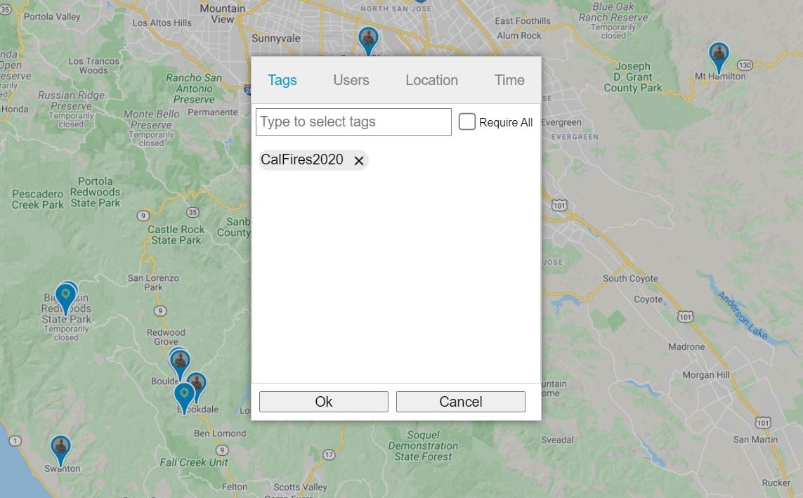
Atlasphere (https://atlasphere.app (opens in a new tab)) is a map-based content publishing system, designed to give geographical and location-based context to disparate collections of information. This past weekend was an experiment in putting it to use in real-time. Mia Wilson and I published a collection of several map markers (opens in a new tab) under the “CalFires2020” Atlasphere tag and promoted them on Twitter (@AtlasphereApp (opens in a new tab), both to inform those following the story on Twitter as well as to experiment with the product I’ve been building. The result was a rush of web traffic, eager for geographical context to stories they may have seen separately.
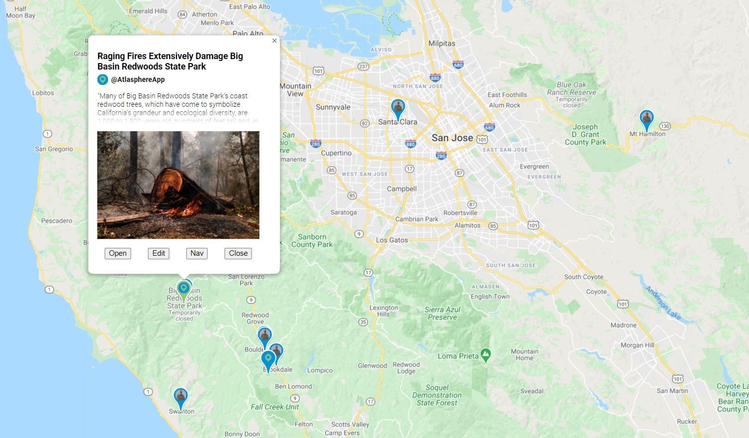
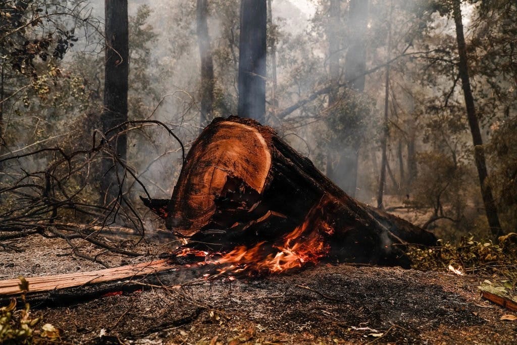
For example, we pointed to the first report from Big Basin Redwood State Park (opens in a new tab), regarding the devastation, providing a satellite map view that showed the vast surrounding forest around the historic Park Headquarters that were thoroughly destroyed. Readers could zoom in and out, or change to street view using familiar Google Map controls to gain further context. And, of course, links in the detail page directed them to the original Mercury News article (opens in a new tab).
Readers could also click on other map items that told more of the surrounding story. By zooming out, they could see, if they didn’t already know, the proximity of the State Park to the town of Boulder Creek (opens in a new tab) which was under constant threat by the fire. As the story developed and reports indicated that Highway 9 was a strategic defensive line, you could see through the map how west of Highway 9, including Big Basin and the neighborhoods surrounding the Boulder Creek Golf Course, fell victim to the fire, while those, such as my family, residing east of Highway 9 held their breath and hoped.
Atlasphere is a collection of hundreds of map markers, but it allows authors to specify exactly the content they want to show in a geographically-relevant manner. In these examples, “CalFires2020” served as the pertinent tag with no further filtering on content authorship or time periods. The simplest filter told a valuable story.
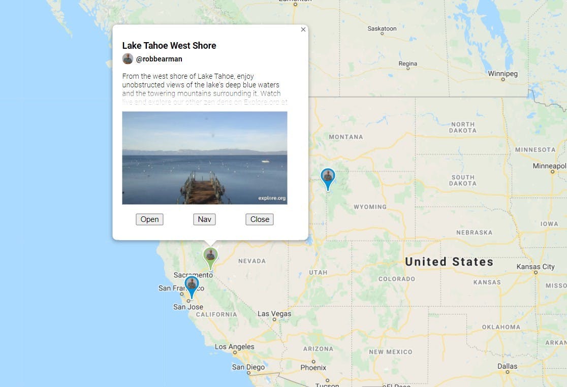
In browsing around my favorite Atlasphere view, which is a world-wide collection of live webcams (opens in a new tab) I noticed something striking: dense smoke obscured the horizon from the San Francisco Bay Area, to Eastern California, and as far away as the Grand Tetons in Wyoming. I created an Atlasphere collection, filtering the Webcams tag with an additional, required tag labeled “Smoke” and posted the link (opens in a new tab) to Twitter as a real-time, you-are-there illustration of the widespread effect of the fires.
Atlasphere is in ongoing development, but it’s already a powerful means for communicating, telling stories, and providing critical information. If you’re interested in creating an account so you can post content, let me know as it’s currently limited to invitation-only. I’m also interested in talking with potential co-founders or those generally interested in the concept.